The River Stour, Dorset, England
Welcome to a celebration of the natural beauty of the River Stour that meanders through the Dorset countryside in England. The Stour Valley Way is a designated footpath that follows almost all of the 64 mile course of this magnificent river.
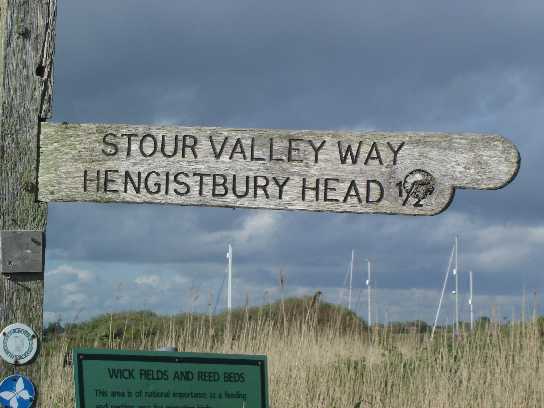
Sign Post to Hengistbury Head
Call 01202 983858 for a free quote
info@aqua-tight.co.uk
Visit
Aquatight.co.uk

The River Stour rises at the lakes at Stour Head in Wiltshire but most of its course is within the boundaries of Dorset. This site currently describes walks and access to the river Stour at the southern end of the river,around Christchurch, Bournemouth, Wimborne and Sturminster Newton. On the left is a list of links to more detailed pages. Each link describes a different walk along this quintessentially English river.
The River Stour is about 64 miles long. The Stour Valley Way now covers almost all of the river, with a few gaps and discontinuities which should do little to deter anyone who wants to explore the river. The final stretch of the Stour Valley Way actually follows the course of the twin rivers Stour and Avon. Ten thousand years ago these two rivers used to follow different routes to the sea with the Stour flowing out to the South-West of Hengistbury Head (following a course across Barn field at Hengistbury Head) and the River Avon following roughly the same route now taken by the twin rivers. Over many millennia the two rivers eroded the land that separated them and finally joined together just East of Christchurch Quay.
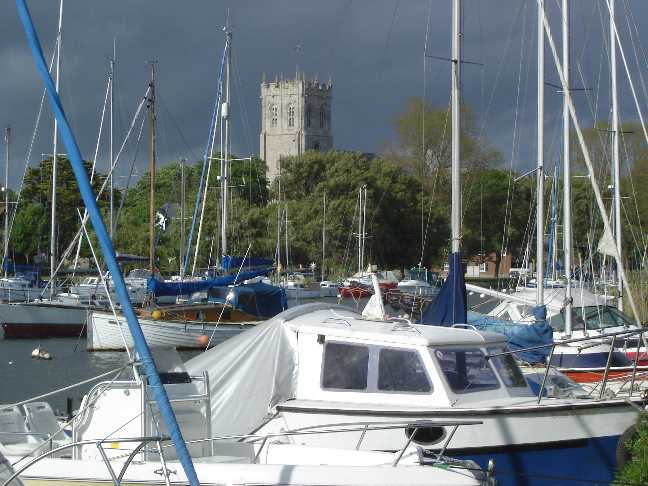
The moorings at Quomps looking across to The Priory
While the lower reaches of the River Stour are heavily populated with pleasure craft, the only commercial boats remaining on the river are a handful of fishing boats and the passenger ferries that convey holiday makers to Mudeford Sandspit from Tuckton and Christchurch Quay.
It was not always like this. In Victorian times coal was shipped to Christchurch Quay and unloaded.The barges were then ballasted with Ironstone bolders (called Doggers) taken from nearby Hengistbury Head before they returned to Southampton.
Quick Lime was produced on and around Hengistbury Head and then shipped inland up the Stour and Avon from landing stages and docks on the rivers edge or in the harbour. In the 17th-18th centuries the river was also used for smuggling contraband inland with the Fiddleford mill near Sturminster Newton being used as a storage depot.
After the junction of the two rivers they meander down into Christchurch Harbour. The main river flow winds down past Hengistbury Head, then follows along Mudeford Sandpit and enters the sea through a narrow channel known as "The Run". The rivers are both tidal for the last few miles of the course. Christhcurch harbour is heavily dependant on the tide. It is normally, even at high tide, a shallow harbour with boats with a draught of more than 3 feet having difficulty entering or leaving. Christchurch harbour is known as a "Rhia" which essentially means it is a drowned river mouth. The run, which is the exit for the river can flow out at an alarming rate when the tide has turned. It can easily defeat even some motor craft trying to enter the harbour.
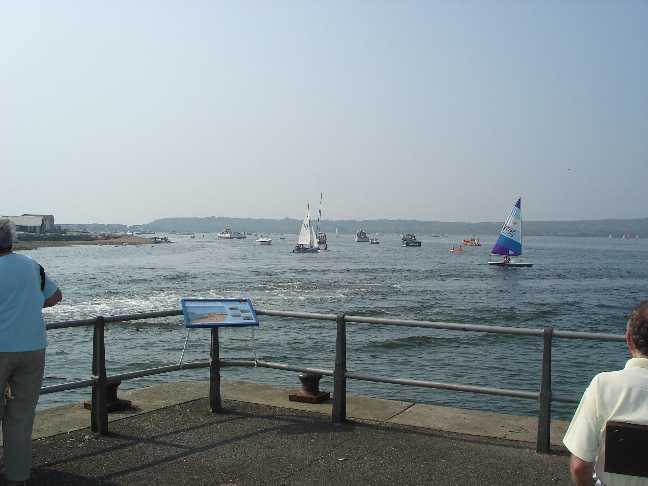
The harbourside of the Run from Mudeford Quay. Here the water is always busy and temperamental
Not all of the river is open to boats. As you go further inland the tidal aspect of the river declines. Low bridges hinder sailing craft so few (if any) are found beyond Tuckton Bridge. Motor vessels can go up to Iford Bridge but that seems to be the limit of navigability. Further up stream, about 2 miles beyond Iford Bridge, there is as set of rapids where the river shoals over rocks. Certainly no boats would go beyond this!
The Stour Valley Way is accessible almost all through the year. Obviously during periods of heavy rain sections of the path, especially in the quieter areas can becomes water-logged. It is always worth-while to be aware that the river can and does regularly flood over its flood plain (which of course includes the footpath) During normal weather it is usually completely safe but during periods of heavy rain, when flooding is likely to occur, due care should be taken. Also be aware that there is usually a time-lag between heavy rain and the river swelling.
As you go beyond Iford Bridge the Stour Valley Way becomes less crowded. Fewer people use the Stour Valley Way inland. The paths around
Sturminster Newton and Wimborne, while far from solitary, are much less used than around Christchurch. The same could be said for the stretch between Wick Ferry and the Double Dykes at Hengistbury Head. The rough path discourages many but is well worth the effort.
As the river winds its way through the countryside its speed varies considerably within relatively short distances. At one point it is fast flowing over rocks and a few hundred meters further along it is slow enough for Water Lilies to grow. Almost the whole river course is embedded within lush vegetation. The river offers a constantly varying set of habitats. Many rare species of plant and animal have the River Stour as their home.
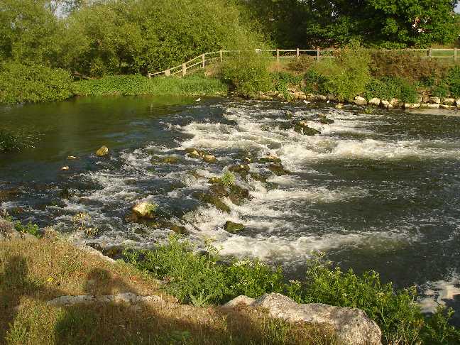
The rapids about two miles upstream of Iford Bridge
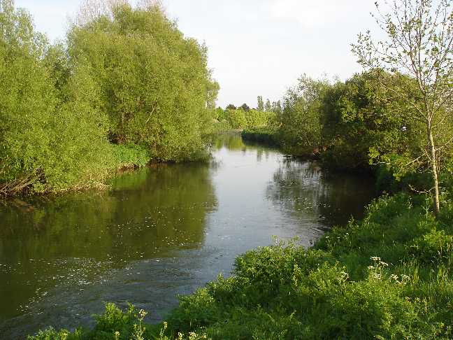
A view down river about a mile up from Iford Bridge
I hope you appreciate and enjoy the Stour Valley Way as much as I do. I will be expanding this site as and when I get the chance to walk more along this beautiful river.
Kind Regards
Bill